Mission Trails: 8,000 Acres of Wild Country Inside the City Line
Cowles Mountain is the highest point in San Diego, the Old Mission Dam predates statehood, and the whole park is a 20-minute drive from downtown.
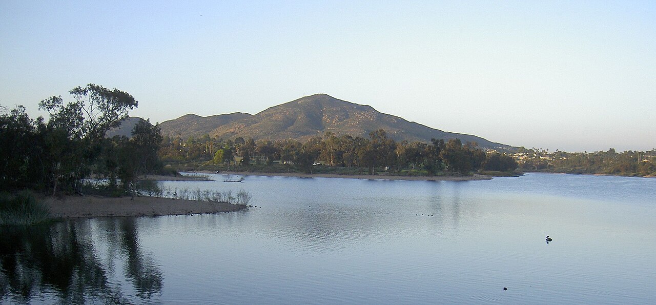
Mission Trails Regional Park is one of the largest municipally owned parks in the United States — nearly 8,000 acres of chaparral, oak woodland, and rugged peaks inside the city of San Diego, stretching from Tierrasanta and Santee to the San Diego River. For most residents it is simply the place where the city's grid gives out and the backcountry begins.
The park's summit is Cowles Mountain, at 1,591 feet the highest point within the city limits. The trail from Golfcrest Drive climbs roughly 950 feet in a mile and a half of switchbacks and is, on any clear weekend morning, one of the most popular walks in the county. The payoff is a full-circle view: the Pacific to the west, Mexico to the south, and Cuyamaca and Palomar country to the east.
Older than the trails is the Old Mission Dam, a National Historic Landmark built by Kumeyaay laborers in the early 1800s to carry water from the San Diego River to Mission San Diego de Alcalá — among the first irrigation works of its kind in California. The dam and its flume system are a reminder that this landscape was farmed and engineered centuries before it was a park.
The Kumeyaay presence in the valley runs far deeper than the mission era. The park's visitor center at the Father Junípero Serra trailhead includes exhibits on the region's first people, and the river corridor the park protects was home to the village of Kosaii long before Spanish contact.
November is prime season here: the summer heat breaks, the sycamores along the river turn, and rattlesnakes grow scarce on the trails. Rangers still counsel the standard kit — water, a hat, and an early start. The park opens at sunrise, and the mountain is best before the day warms up.